An aerial view of a part of the Ennore-Pulicat wetlands. Photo: Palani Kumar.
Chennai: Adani Ports and SEZ’s subsidiary Marine Infrastructure Development Private Ltd has submitted a “Draft Comprehensive EIA/EMP Report Proposed Revised Master Plan Development of Kattupalli Port.” The submissions are in three volumes. The current application is for environmental clearance for a Rs 4,000 crore port and harbour project that is part of a Rs. 53,400 crore masterplan. It additionally contains port back industries, an industrial area and associated infrastructure.
Set to come up on wetlands and ecologically fragile sand dunes on the Kattupalli Barrier island near the Pulicat Wildlife Sanctuary, the company’s proposal for a megaport is illegal on several counts. By falsifying vital information and suppressing other critical facts, it has managed to get its proposal past the Expert Appraisal Committee of the Ministry of Environment, Forests and Climate Change.
The Tamil Nadu Pollution Control Board’s announcement to hold a public hearing for the project on January 22, 2021, has triggered massive outrage among local communities, environmentalists and political parties. The DMK, MDMK, Tamilnadu Vazhvurimai Katchi, Naam Tamilar Katchi, Tamil Nadu Manithaneya Makkal Katchi and the left parties have already condemned the project citing illegalities, threat to livelihoods, increased flood risk and the threat to the sanctuary.
The Adani megaport is also seen as a backdoor entry for the controversial Salem-Chennai eight-lane expressway project that saw pitched protests by farmers and environmentalists upset with the proposed conversion of forests, farmland and wetlands into a highway with questionable benefits.
Drawing from public documents and project documents submitted by Adani, the following essay highlights how the project – a prohibited activity at the proposed location – will harm local environment and livelihoods and endanger Chennai’s water and flood security.
Adani Port – Key Information
Investment: A sum of Rs 53,031 crore is mentioned as the total capital cost for the proposed Revised Master Plan development spread over a construction period of 20 years.
Employment potential: Direct employment – 1,500 people; indirect – 4,500 people 20 years from now.
Investment per job: Rs 8 crore/job (direct + indirect)
Cargo handling capacity: 24.65 million tonnes per annum (MTPA) is the port’s current total handling capacity, proposed to be increased to 320 MTPA, which is a third of the combined capacity of all ports in India, and more than the total capacity of all major and minor ports in Tamil Nadu. (The total capacity of major ports in Tamil Nadu is currently 275 MTPA.)
Cargo proposed to be handled: Revised Master Plan, Development of Kattupalli Port. involves handling and storage of multipurpose cargoes – including liquids, coal, iron ore, bulk, break bulk, project cargo, general cargo, dry cargo containers, fertiliser and fertiliser raw materials, Ro – Ro and Automobiles and any other non-hazardous cargo and liquid, gas, cryogenic (up to -162º C) cargoes, including all class A, B and C petroleum products, excluded petroleum products, non-classified chemicals and petroleum products, hazardous, toxic and non-hazardous chemicals/liquids and other liquid cargoes, including LNG/CNG/LPG.
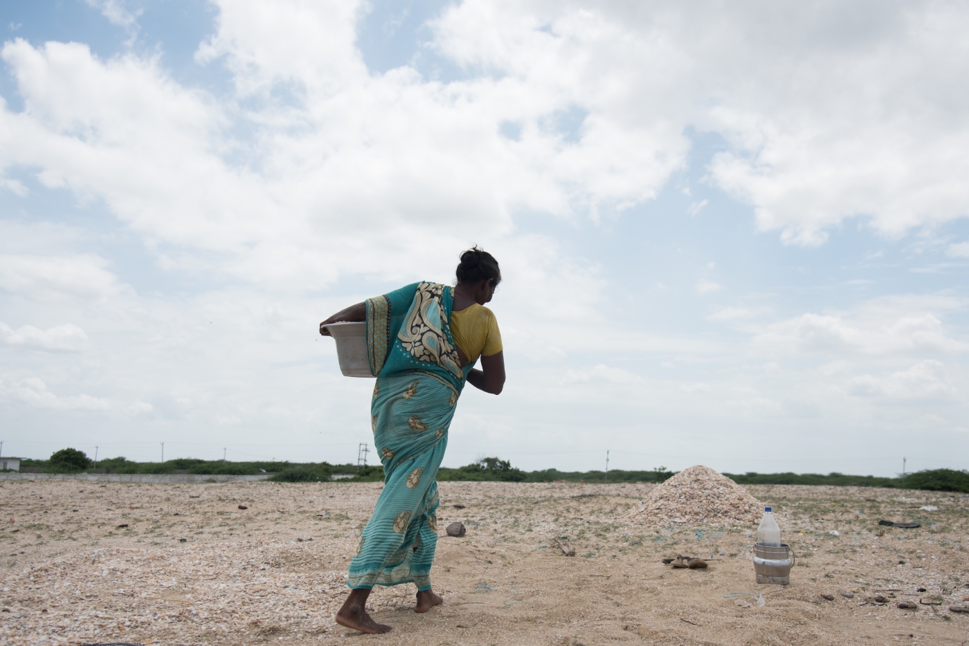
Land use: According to the EIA, the port is proposed to be expanded from its current area of 330 acres to 6,111 acres. Of this, 2,000 acres is to be created by dumping dredged sand into the sea. At least 3,200 acres of land identified by MIDPL in its EIA for the port masterplan is classified as poramboke wetlands – springs, ponds, canals, salt marshes and salt pans – in revenue documents. The remainder is private land. The wetlands will be landfilled to create land for a petrochemical industrial area.
Breakwater length: The length of new proposed breakwaters is about 12.1 km. The two new breakwaters are northern breakwaters (9.02 km and 1.22 km) and a southern breakwater (1.86 km).
Dredged and quarried sand: A total of 138 million cu. m of sand will be required. Dredged sea sand will contribute 85 million cu. m, and 53 million cu. m will be quarried from the Palar basin. The sand dredged from the basin alone will suffice to meet the sand needs of all of Tamil Nadu for six months. The sand will be used to reclaim 2,000 acres of sea and 2,000 acres of tidal wetlands and low-lying areas.
Rocks: A total of 50 million tonnes of rocks will be required for the breakwaters. This will be blasted and removed from undisclosed quarries. That is 17-times more than the quantity of rock required for India’s longest breakwater, at Kamarajar Port.
Seawater intake for regasification of LNG: 1,20,000 m3/h. Seawater will be used to vaporise liquefied natural Gas which is transported at under pressure at -162º C. This large volume of seawater used to warm and vaporise the LNG will be very cold and will be discharged into sea at sub-zero temperatures.
Length along coast (south to north): Old length – 2.144km; new – 8.144 km
An Illegal Project
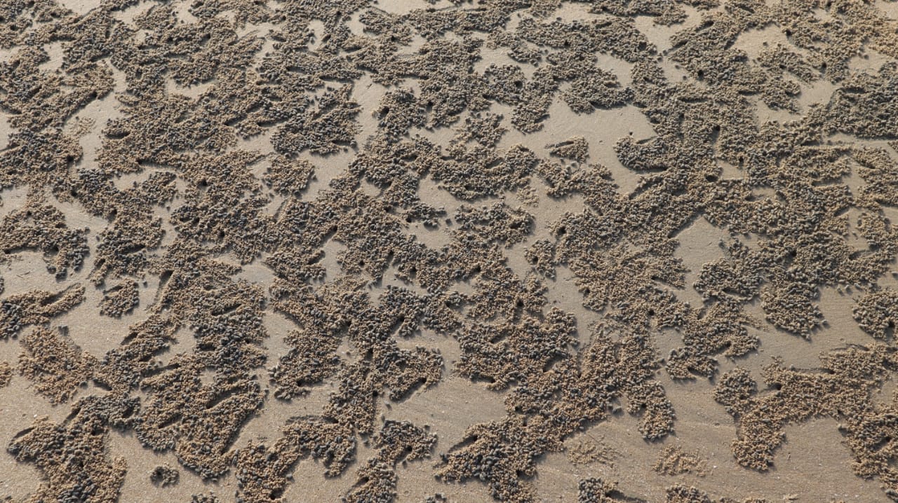
Illegality 1: The project is prohibited under Coastal Regulation Zone Notifications 2011 and 2019. Under both these notifications, the project siting is illegal. Ports are not permitted to be set up in high-erosion zones. Adani has suppressed vital information from the Ministry of Environment, Forests and Climate Change in its application for environmental clearance. It has hidden the fact that the project location is already experiencing environmental damage and is susceptible to more, in the form of coastal erosion.
The Government of India defines a high-eroding stretch as a beach that is eroding at the rate of 1 metre/year.
A 2006 study by Ministry of Earth Sciences, Government of India, establishes that “Along north coast of Ennore port (Fig 2.32f), the beachfill area is undergoing severe erosion at the rate of 50m per annum (Even though the coast was protected with beachfill of 500m offshore).” The study finds that: “Now with the construction of Ennore port, 16 km North of Chennai port, another erosion problem has emerged and similar issues like Chennai port are on the way. If no intervention is planned, threat to ecologically sensitive Pulicat Lake is inevitable” (emphasis added).
– Source: ‘Shoreline Management Plan for Ennore Coast’, Ministry of Earth Sciences, Government of India, November, 2006
According to the company’s own environment impact assessment (EIA), the coast on which the project is to be located is eroding at 8.6 m/year due to the existing Kattupalli and Kamarajar Ports.
The EIA also admits the project will double the erosion rate to 16 m/year. If erosion control measures are implemented, erosion will be reduced to 8 m/year in areas where such measures are in place. However, these measures will shift the erosion further north. where fishing villages and the sanctuary lie, according to the EIA itself.
Illegality 2: The project is prohibited under the Environmental Protection Act 1986. Polluting industries are not allowed in the eco-sensitive zones within 10 km of a national park or sanctuary. Ports are a large, red category, hazardous industry. The proposed port is between 2.1 km and 3.4 km from the sanctuary. In its application for environmental clearance, Adani (the company) has falsified information relating to distance from the sanctuary. Disclosure at the application stage would have resulted in disqualification of the project as it is a prohibited activity within the eco-sensitive zone. The project has come to the public hearing stage through fraudulent means, by falsifying information.
Illegality 3: The conversion or encroachment of water bodies is prohibited. Numerous government orders and high court judgements have ruled against the encroachment and diversion of water bodies. Water bodies are classified as poramboke and cannot be purchased, sold or built upon. The project aims to enclose 2.300 acres (927 hectares) of “Government lands” or Poramboke commons, including 2,000 acres of various wetlands – ponds, spring channels, salt marshes, tanks and salt pans.
The Pulicat lagoon has been identified as one of 14 priority wetlands in Tamil Nadu.
Unnecessary Project
Adani’s proposal to set up a mega-port capable of handling 320 MTPA makes no business sense. Consider the following: All major ports in Tamil Nadu put together have a total cargo handling capacity of 253.9 MTPA. But total cargo handled in 2019-2020 (before the COVID-19 lockdown) was a meagre 114.9 MTPA. In other words, 55% of the existing port capacity in Tamil Nadu is lying idle. Bringing in a new mega-port is not only not justified – its viability hinges on killing the business of existing ports. That will have a dangerous impact on the jobs of people already working in these facilities.
False Claims, Suppressed Facts and Understatements
1. Understated Facts (fires, explosions, toxic leaks – danger to Kattupalli, Kattupalli Kuppam, Kalanji, Urnambedu, Senganimedu): Hidden in one of the three large volumes that are part of the EIA document submitted by Adani are eight drawings with a deadly message. The modelling of catastrophic failure involving various hazardous substances like butane, epichlorohydrin and acrylonitrile presents scenarios where entire villages can be wiped out in minutes. That is because hazardous, inflammable, explosive and toxic chemicals are stored and conveyed through populated areas and settlements.
For instance:
– A pipeline leak of epichlorohydrin could result in a fireball that could incinerate the settlement of Kattupalli Kuppam and everything else within a radius of 1.3 km.
– A butane unloading arm failure could result in an explosion violent enough to shatter concrete and cause widespread deaths in a radius of 2.6 km covering the villages of Kattupalli Kuppam and Kalanji.
– A propane unloading arm failure could likewise result in a violent pressure wave that can cause widespread casualties in a radius of 2.4 km covering Kattupalli Kuppam and Kalanji villages.
– A leak of toxic acrylonitrile could poison all surrounding villages within a radius of 2.7 km, including Kattupalli, Kattupalli Kuppam, Kalanji, Urnambedu, Senganimedu and Ramanathapuram.
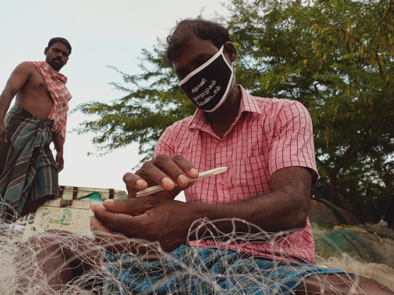
2. Understated facts (livelihood and women’s role in economy): The EIA attempts to portray the lands targeted for industrialisation as empty, barren and unused. The fishery study carried out on behalf of Adani says marine resources are poor. However, the same study also records that just the three villages of Kattupalli Kuppam, Koraikuppam and Vairavankuppam catch about 4.5 tonnes of fish a day. Even assuming a mere 100 fishing days in a year, the total annual fish catch works out to 450 tonnes which is by no means an ordinary amount.
The marine area proposed to be reclaimed for creating 2,000 acres of port land will obliterate at least six named fishing grounds: Karungali seru (seru is tamil for ‘mud’), Alamaram seru, Kalanji seru, Lock seru, Kalanji Koda seru and Koda seru. The locals refer to the muddy-bottomed prawn and crab habitats dotting the nearshore areas as the “reserve bank” because of the perennial availability of cash-fish.
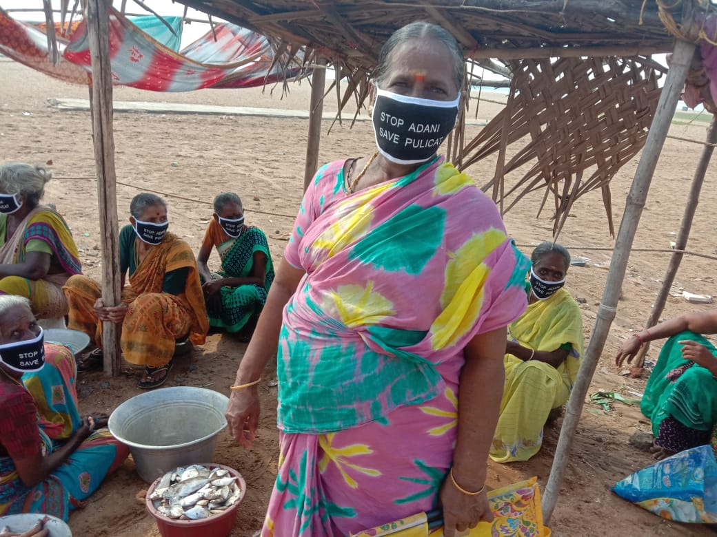
Women’s labour: The fishing economy depends heavily on women’s labour. More than 300 women, from the villages likely to be impacted by the port, are involved in processing and fish vending in nearby markets. The availability of fish at beach landing sites is critical to the participation of women. So the destruction of beaches by port-induced erosion will rob the women of their livelihoods as boats will be forced to land their catch at faraway landing sites.
Additionally, more than 1,500 women are engaged in fishing for prawn and crab in the backwaters.
On the western-side villages of Urnambedu, Senganimedu and Kattur, a thriving cattle economy exists, driven substantially by women. The alienation of grazing grounds for the project, the imminent harm to water resources and degradation of the general environment is likely to impoverish those dependent on livestock.
The project documents make no mention of the cattle and livestock economy or the women and men depending on them.
3. False claims (contaminated areas): New and polluting industries are not allowed in areas already subjected to environmental degradation or pollution. In its EIA and application form, the company falsely declares that there are no polluted areas in or near the project site.
However, the data in the EIA tells a different story:
– Soil is hazardous waste: Soil from some sampled locations contained zinc in quantities exceeding Indian hazardous waste threshold of 720 mg/kg (1,198 mg/kg, 1,174 mg/kg and 1,187 mg/kg). So soil at these location(s) will have to be treated as hazardous waste.
– Estuarine water quality: Cadmium levels were 14- to 20-times higher and mercury levels 24- to 51- times higher than Canadian water quality guidelines for the protection of marine life.
– Estuarine sediment quality: Cadmium was above danger levels in sediment samples from all locations. Mercury was above safe levels in all, and above danger levels in some locations, according to Canadian Sediment Quality Guidelines for the protection of aquatic life.
– Marine water quality: All seawater samples in all seasons were contaminated with mercury and cadmium. Cadmium was 13- to 27-times higher than safe levels specified in the Canadian Water Quality Guidelines. Mercury was 12- to 53-times higher than safe levels.
– Marine sediment quality: All samples contained mercury and cadmium in excess of safe levels. Cadmium concentration exceeded even danger levels in all samples. Mercury concentration exceeded levels considered dangerous to marine life in samples taken from 29 out of 36 locations.
Dredging such contaminated sediments will worsen water quality and further endanger fish populations and fishers’ livelihoods. By law, the site and its vicinity should be subjected to urgent remediation.
4. Suppressed facts (erosion control measures will harm fishing villages and wildlife sanctuary): The EIA makes no mention of the danger to fishing villages and the wildlife sanctuary by erosion triggered by the proposed port. However, a study conducted by the Institute of Ocean Management, Anna University, as part of the project EIA, predicts that port construction will cause the Pulicat lake’s shore to erode at 16 metres/year – almost double the existing rate.
Certain erosion “control” measures have been proposed to reduce erosion to 8 metres/year – but the report warns that such measures will push the erosion further north, within the limits of the wildlife sanctuary and villages such as Lighthouse Kuppam, Goonankuppam, Arangankuppam, Thirumalai Nagar, Sembasipalli Kuppam, Vairavankuppam and Koraikuppam.
It is another matter that Adani has failed to implement any erosion control measures for its existing port despite being legally required to do so, under the terms of its environmental clearance. But instead of taking action against the offender, the Tamil Nadu Pollution Control Board has been facilitating its expansion.
Even at the reduced 8 m/year erosion rate, the thin sand barrier separating the Pulicat lagoon from the Bay of Bengal will be breached within 12 years. Without intervention, the bay will subsume the lagoon in 6.5 years, obliterating the fishing villages.
Fourteen fishing villages are in danger of losing all or part of their lands to the sea due to erosion triggered by the proposed port, while areas as far away as Gummidipoondi and Tada in Andhra Pradesh are likely to be exposed to extreme marine events when the sea advances into the lagoon.
While the study conducted by Adani’s EIA consultant says construction of the port will markedly slow ocean currents near the Pulicat estuary, it fails to assess the impact of such a slowdown on the nearby villages. and the Sriharikota island housing India’s celebrated spaceport.
5. Suppressed facts (important turtle nesting beach): Kattupalli’s beaches all the way to the Pulicat estuary are an important nesting ground for the olive Ridley sea turtles, a threatened species listed under Schedule 1 of the Wildlife Protection Act. Recognising the importance of the turtle nesting beaches, the Tamil Nadu forest department regularly patrols the beaches at night during the nesting season (January to April), and has set up a turtle hatchery in Pulicat.
Adani’s proposal will close off 6 km of the beach up to Karungali estuary, which is one of the busiest turtle nesting sites on the island. Increased shipping traffic will heighten the mortality of turtles moving to and from their nesting sites.
The EIA does not mention turtles even once.
6. Suppressed fact (hiding an estuary): Karungali estuary, which acts as a pressure-valve when floodwaters overwhelm the Pulicat and Ennore estuaries, has not been mentioned in any of the project documents. The estuary will be blocked off by the port’s northern breakwater. Local fishers report that the usually blocked estuary opens to the sea during heavy rains, when excess water is released from Pichatur reservoir in Andhra Pradesh. Blocking the estuary will aggravate floods in Periyapalayam, Arani, Ponneri, Somancheri, Perumedu and Kattur.
7. Suppressed fact (flooding): Encroaching on water bodies is bound to have an impact on flooding. A substantial portion of the Ennore-Pulicat backwaters are proposed to be filled up to 4.4 metres above sea level. Experts who have studied the EIA report confirm that “such high level of filling on the floodplain will have significant effects on the drainage during large flood events.”
However, while the figures in the EIA indicate heavy flooding in areas to the west of the proposed port, the document fails to identify the settlements that are likely to be submerged and the extent and duration of such submergence. From the map presented, it is clear that the villages of Urnambedu, Senganimedu, Ramanathapuram and Kattur will likely be at risk due to the proposed encroachments.

The rainwater run-off from the paved surfaces of the project site is likely to overwhelm the carrying capacity of the river leading to further flooding, and potentially the backing up of water in low-lying areas of North Chennai and Athipattu. However, no studies have been undertaken to verify or negate this.
The proposed project puts at risk more than 10 lakh people in four assembly constituencies of R.K. Nagar, Thiruvottiyur, Madhavaram and Ponneri.
9. Suppressed fact (salinity intrusion): Paving over sand dunes and wetlands, both of which are storehouses of freshwater, will retard groundwater recharge and weaken the natural defence against seawater intrusion into local aquifers.
The freshwater aquifers of Araniyar-Kosasthalaiyar basin are vital to Chennai’s water security. However, well fields operated by Chennai Metrowater are already under stress due to overextraction and salinity intrusion. The proposed project will aggravate salinity intrusion into this vital aquifer and further endanger Chennai’s water security.
10. Understated claims (poor biodiversity): The EIA report underreports the fish and species diversity of the oceans and the Ennore-Pulicat wetlands, which are remarkable despite the harm done by industries and ports in the region. S. Kannaiyan, former chairperson of the National Biodiversity Authority, has described the lake as follows:
“It is a vast nursery of about 12 species of prawns, 19 species of crabs and 168 species of finfish and harbours several endemic, endangered and keystone species. During 1995-2003 an annual average of about 77,000 waterfowl belonging to 37 species sojourned on this lake during winter season, of which at least 25 species breed at the nearby areas.”
The EIA doesn’t once mention the olive Ridley sea turtle (Lepidochelys olivacea).
In fact, the reports a mere 32 species of birds from the area – which contains a bird sanctuary of international repute. The citizen science database ebird documents 224 species for the area. Just on October 17, 2020, the database indicated 50 species sightings.
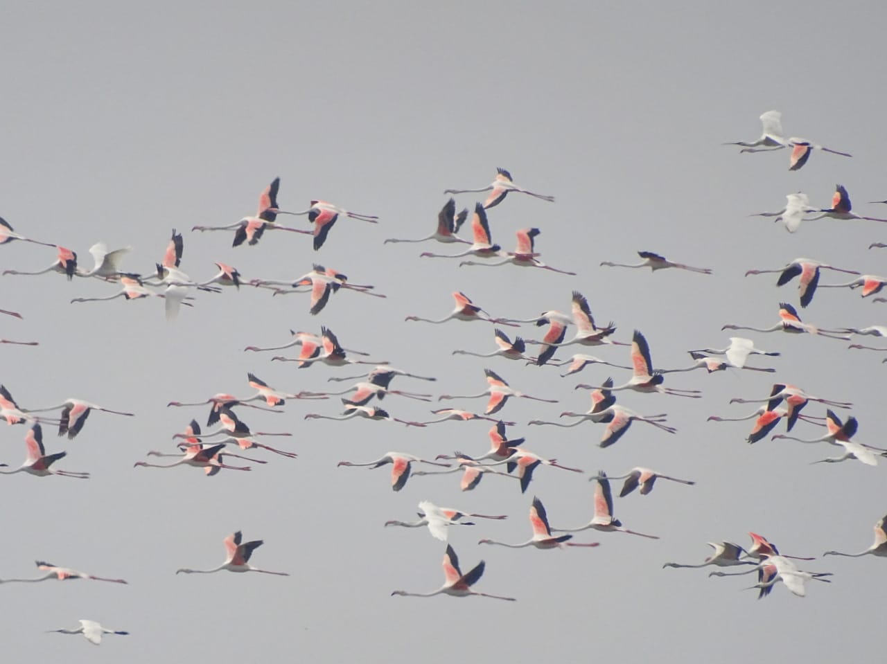
The biodiversity section of the report is its weakest, with conclusions based on one-day day-time observation. Night-time surveys have not been conducted, resulting in the exclusion of nocturnal life.
Nights are a busy time for wildlife, insects and certain birds.
This lapse has material consequences.
12. Missing information (damage to shoals): The nearshore area off Kattupalli island is protected by a peculiar formation called the Ennore shoals. The shoals make up an elevated ridge of sand that runs in a northeasterly direction from Ennore estuary to Pulicat estuary. Because they lie parallel to the coast, like a barrier rising from the ocean floor, they slow incoming waves and mitigate erosion and the violence of the sea during storms.
The southern part of the shoals were destroyed during the construction of the Kamarajar Port and the L&T Port. Adani Port now proposes to expand the entrance to the harbour from 180 m to 500 m, and dredge the shoals to a depth of 27 m to accommodate a larger. deeper approach channel for big ships.
Such a move will aggravate erosion in an already eroding stretch and expose the fragile island to the ocean’s full ferocity.
Polluting the Airshed
The megaport proposal hinges on the potential for “increased container traffic in the vicinity of Chennai, as well as from the proposed Ennore SEZ adjacent to the site. … Thermal power stations of NTPC, NCTPS and major refineries are located in the northern suburbs of Chennai leading to huge potential for coal, crude and POL products.”
Adani’s fossil-fuel dreams will likely accelerate the unfolding climate nightmare. But more locally and immediately, the increased vehicular activity and creation of a 2,500-acre petrochemical industrial estate in an already polluted airshed will have grave ramifications for the local air quality locally and seasonal air-quality over Chennai.
The Ennore-Manali industrial area is already severely polluted. Local residents and children from the area complain of poor air and the risk of accidents from the busy traffic of heavy vehicles on the area’s pot-holed roads.
Adani’s EIA confirms this – and predicts that this will only get worse if the port is eventually built.
Traffic passing through the Manali industrial area is already at an unhealthy high. Average daily traffic through this region is at 40,335 passenger car units (PCUs: the equivalent of that many passenger cars). Multi-axle and two-axle vehicles, i.e. trailer trucks and lorries, account for 43% of total traffic. Two-wheelers carrying local commuters make up another 38%. It’s no wonder that this stretch is an accident-prone zone. The high traffic also contributes substantially to local air pollution from diesel emissions and resuspended road dust. If the port project materialises, traffic in this region is expected to increase to 54,864 PCUs.
A similar situation threatens to unfold in Kattupalli, where the village road linking Kattupalli to Pulicat in the north and Chennai in the south will be overrun with industrial vehicles, imperilling the lives of local residents. Even without an expanded port, the residents of Kattupalli, Kalanji and Karungali have to access Chennai (for emergencies like deliveries and medical conditions) through the crowded port traffic.
In Adani’s EIA, the Kattupalli road/port access road registered traffic of 18,916 PCU. Multi-axle vehicles like container lorries accounted for 45% and two-wheelers accounted for 28% of the total.
Disturbance to Public Utilities

Disruption of water supply from Minjur desalination plant: Chennai receives 100 million litres/day of drinking water from the Minjur desalination plant which is located near the existing Adani port. Adani’s new port will put the seawater intake area for the desalination plant within the proposed harbour basin. Oil pollution from the ships in the harbour basin is likely to affect quality of seawater intake for the plant, and affect the RO filters. Adani has proposed that “The realignment of existing intake & outfall of CMWSSB 100 MLD plant, if needed, will be taken up in consultation with CMWSSB” (pp. 4-49 of CEIA, vol. 1A).
Even if such a shift were technically and financially feasible, the realignment exercise will likely disrupt water supply for a long period. If the relocation period coincides with a water-scarce year like 2019, this could cripple the city. The impacts of such a disruption, which could have grave consequences for law and order, and public health in Chennai, have not been assessed.
Realignment of public road: Industrial development of Kattupalli has gravely inconvenienced and endangered local villagers. The construction of Kamarajar Port (formerly Ennore Port) and L&T Shipbuilding and Port (now bifurcated as L&T Shipbuilding and Adani-owned MIDPL) involved the taking over of a public road connecting Kattupalli, Kalanji and Karungali to Ennore and Chennai. A realigned road was constructed from Athipattu to Pulicat. However, this road is unusable for emergencies as it is congested and overtaken by heavy vehicles carrying goods to and from the ports.
Reaching the city from Kattupalli and Kattupalli village, Kattupalli Kuppam and Karungali in the event of a medical emergency is next to impossible.
Now, once again, the existing road is sought to be realigned to accommodate Adani’s proposed railway line. To do this, Adani has proposed that the Government of India-owned Kamarajar Port must shift its compound wall so that the freed space can be used as a road.
Note: This article was updated at 7:10 am on February 26, 2021, to specify the exact area that will be landfilled to create a petrochemical industrial area.
Nityanand Jayaraman is a Chennai-based writer and social activist. He is part of the Save Pulicat Campaign.


